
Difficulties faced by low altitude flight meteorology
-
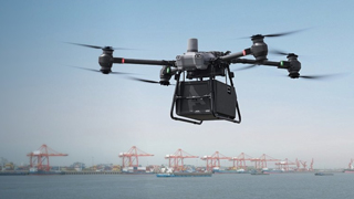
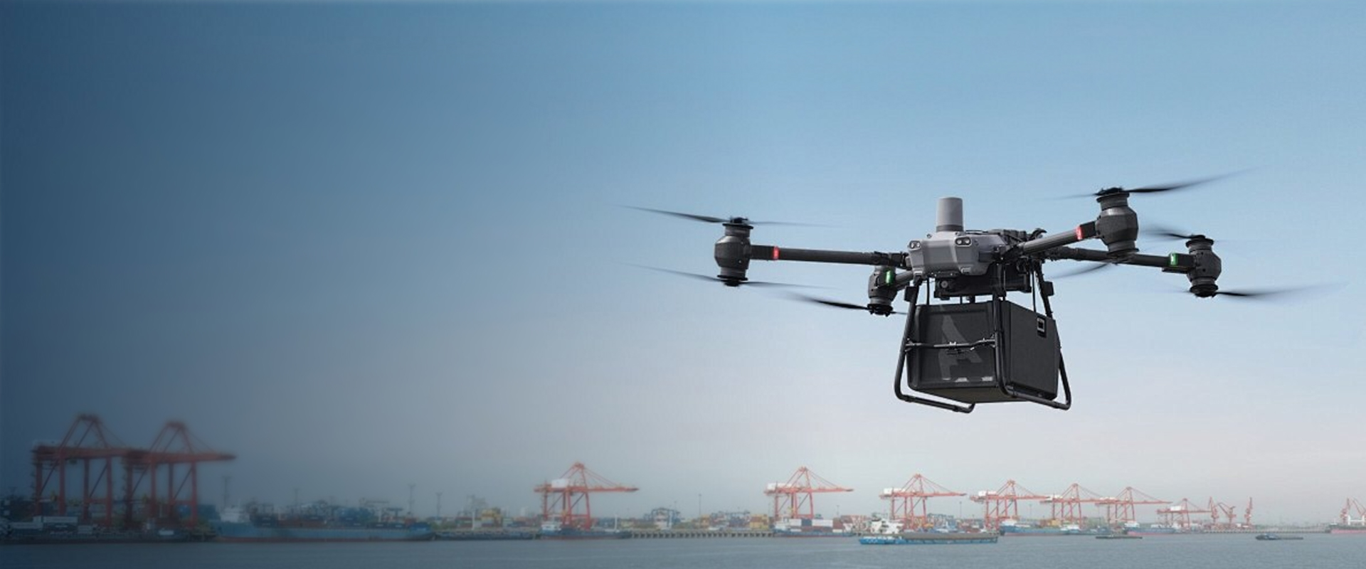
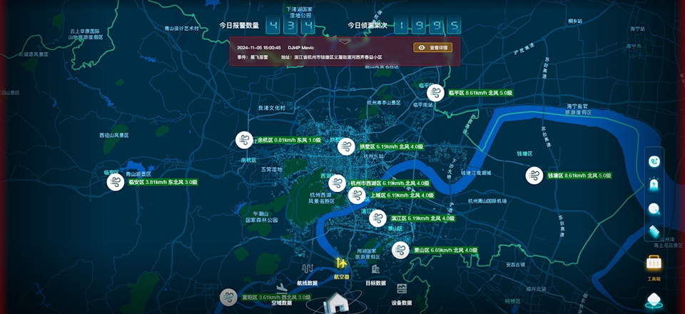
Impact on flight routesThe meteorological risks and difficulties faced by low altitude flight (usually referring to airspace below 3000 meters, such as general aviation, drones, helicopters, etc.) are complex and diverse, mainly related to the high dynamics, suddenness, and interaction with ground terrain of low altitude meteorological conditions. The efficiency and scheduling value of low altitude flight industry routes are closely related to meteorology. Complex and changeable meteorological conditions, such as strong wind, rainstorm, heavy fog, etc., will limit the flight speed and altitude of the aircraft, and even force the aircraft to change its route. This not only increases flight time and costs, but may also lead to flight conflicts, affecting the operational efficiency of the entire route network. Strong wind can increase the difficulty and risk of flight, making the control of the aircraft unstable. When flying against the wind, it can increase power or fuel consumption, reduce flight efficiency, and increase operating costs; Sidewinds may cause aircraft to deviate from their intended flight path and even result in structural damage to the aircraft.Limit the flight speed and altitude of aircraftIncrease flight time and costStrong winds make aircraft handling unstableThe tailwind caused the aircraft to deviate from thepredetermined route
-
Impact on station operationThe meteorological elements that have a significant impact on the operation of the station mainly include wind, air pressure, visibility, and cloud height. Strong winds may affect the safety of aircraft takeoff and landing, and excessive changes in wind speed and direction can increase the difficulty of aircraft control, even causing the aircraft to deviate from the runway. Abnormal changes in air pressure can affect the instrument readings and performance of the aircraft, posing a threat to flight safety. Insufficient visibility can limit the pilot's line of sight and increase the risk of takeoff and landing accidents. If the cloud height is too low, it may prevent the aircraft from obtaining sufficient safe altitude during takeoff and landing, affecting flight operations.Unable to meet the actual monitoring needs
How can we solve it
How can we solve it
-
01
Establish a distributed meteorological monitoring network for flight routes
1. Establish a distributed meteorological monitoring network for flight routes: Establish a distributed meteorological monitoring network in low altitude flight dense areas and key flight routes. This network consists of small, high-precision, and stable meteorological monitoring stations that can collect real-time meteorological data and transmit it to the central server through wireless communication technology. In this way, it can not only make up for the shortcomings of urban infrastructure meteorological services in accuracy and coverage, but also reduce the cost of purchasing and maintaining large meteorological equipment, and improve the efficiency of meteorological equipment investment.
-
02
Construction of automated and intelligent observation system
Introduce automated and intelligent meteorological observation systems to reduce reliance on manual observation. The system automatically measures visibility and cloud height, wind direction, wind speed, air pressure, etc. It collects meteorological data in real time through sensors and transmits the data to the meteorological monitoring center at the station. At the same time, equipped with intelligent analysis software, quality control and analysis of observation data are carried out to improve the accuracy and reliability of observation data.
-
03
Upgrade of high-precision meteorological monitoring equipment at the station
Install high-precision wind, air pressure, visibility, and cloud height monitoring equipment at the station. For example, cloud height meters using new LiDAR technology can measure cloud height more accurately; Use advanced intelligent ultrasonic wind measurement instruments and intelligent air pressure measurement instruments to improve the accuracy and reliability of observations. At the same time, equipped with the Zhi360 integrated monitoring platform data analysis system, real-time analysis and warning of monitoring data are carried out. When key meteorological elements exceed the safety threshold, timely alerts are issued to station operators and pilots.

Application Products
Applied products
TWF10 sensor
The TWF10 sensor is a new generation product that integrates sensor technology, digital electronic technology, and embedded technology. It can achieve real-time remote monitoring of various meteorological elements such as atmospheric environment temperature, relative humidity, atmospheric pressure, wind speed, wind direction, rainfall, visibility, and road surface temperature. It can simultaneously collect data detected by sensors with different elements, analyze, process, store the data, and form a required data protocol for uploading. This device has the characteristics of high automation, simple and convenient operation, low power consumption, high reliability, and easy scalability, which can meet the requirements for stable and continuous meteorological support tasks.
- Real time remote monitoring of multiple meteorological elements
- High degree of automation
- Stable continuity
- Low power consumption and easy scalability
- Economical and practical

Data collector
The Diyuan DY-DAS-1000 data acquisition system is a data acquisition, calculation, and management device suitable for fields such as meteorology, low altitude flight, environment, smart cities, oceans, and new energy. With its rich and diverse data interfaces and various built-in data transmission methods, customizable and remote data processing programs, it is suitable for almost all brands of sensors in the world. Based on the supporting cloud platform, customized data processing, data interaction, remote device diagnosis, configuration, upgrade and other functions can be quickly implemented according to user needs. DY-DAS-1000 will greatly facilitate users to set up and edit various programs according to their needs, making it very easy to operate without any programming foundation or secondary development costs. At the same time, it will improve the efficiency of equipment maintenance and management, greatly reducing the cost of later maintenance.
- General measurement
- Data Expansion
- remote diagnosis
- No programming foundation required
- Very easy to operate
- Diverse communication methods
- Rich page configuration

360 Integrated Monitoring Platform
The 360 integrated monitoring platform adopts advanced sensing technology and cloud architecture mode to collect meteorological and environmental data such as temperature and humidity, atmospheric pressure, wind speed and direction, rain and snow rainfall, PM2.5/PM10 air quality, etc. It is connected to the cloud through wired or wireless GPRS to achieve automatic storage and online analysis and monitoring of meteorological and environmental data. Users can access cloud services for meteorological, environmental, and other data information within the environmental area by logging into the system through PC or mobile devices.
- 360 Integrated Monitoring Platform
- sensing technology
- Cloud architecture mode
- Automatic storage of data
Program value
Program value
-
Enhance flight safety
Through precise meteorological monitoring and timely warning, reliable meteorological information is provided for low altitude aircraft, helping pilots and operators prepare in advance, effectively reducing the threat of meteorological factors to flight safety, and ensuring the safety of personnel's lives and property.
-
Improve operational efficiency
Accurate meteorological data can help aircraft optimize flight plans, arrange takeoff and landing times and routes reasonably, reduce flight delays and cancellations caused by meteorological reasons, improve flight efficiency, and reduce operating costs. For unmanned aerial vehicles and other equipment, flight tasks can be planned reasonably based on meteorological conditions to improve work efficiency.
Relevant news/information
Recommended products